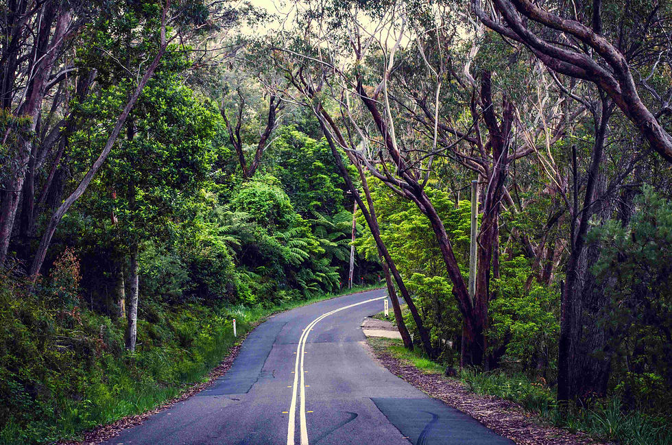


Waterfall Way Road Trip Guide & Map: Waterfalls, Rainforest and Regional Villages

Updated: Oct 20
WATERFALL WAY ROAD TRIP
Waterfall Way is often described as a waterfall drive. That description misses the point.
The real appeal lies in the contrast.
One moment you are standing on the New England Tablelands surrounded by granite country and cool-climate towns. A few hours later you are descending through rainforest, waterfalls and mist-covered escarpments towards the coast.
Waterfall Way is not simply a scenic road. It is a journey between entirely different landscapes.
quieter and more immersive.
Why Waterfall Way Rewards Slow Travel
Waterfall Way is not a road designed for rushing. The waterfalls are impressive, but many of the strongest memories come from lingering in villages, stopping at unexpected lookouts and taking time to appreciate the changing landscapes.
The road encourages detours. It rewards curiosity.
Like many of Australia's great regional journeys, the best bits often happen between the famous attractions.This is a road journey built around:
scenery
atmosphere
slower travel
nature
changing landscapes
WHERE IS WATERFALL WAY?
Waterfall Way connects:
Coffs Harbour
Dorrigo National Park
Bellingen.
Armidale.
The route crosses dramatic escarpment country where rainforest and waterfalls dominate the landscape.

BEST STOPS ALONG WATERFALL WAY

World Heritage rainforest with:
skywalks
waterfalls
walking trails
subtropical forest
One of Australia’s highest waterfalls plunges dramatically into Oxley Wild Rivers National Park.

Few places showcase the scale of the New England escarpment better than Oxley Wild Rivers National Park.

Waterfall Way's greatest surprise may not be a waterfall at all. The riverside village of Bellingen offers cafés, galleries and a relaxed atmosphere that encourages travellers to slow down and stay longer than planned.

A creative riverside town known for:
cafés
markets
relaxed atmosphere
rainforest surroundings
Historic New England town is an ideal base for exploring Waterfall Way and remains one of regional New South Wales' most underrated destinations.

overnight stays
national park access
slower regional travel
WHY WATERFALL WAY FEELS SO MEMORABLE
The changing landscapes create the magic.
One moment: humid rainforest.
The next: open escarpments and highland country.
The drive naturally slows travellers down through:
winding roads
lookout stops
waterfalls
small towns
changing weather
SLOW TRAVEL TIPS
Waterfall Way works best when:
travelled over several days
combined with short walks
explored after rainfall
approached slowly
The road is not about reaching a destination quickly.
The journey itself is the experience.
Waterfall Way reminds travellers that Australia's most rewarding road trips are often found far from the country's busiest tourism corridors. The real joy lies in the unexpected village, the unplanned stop and the road that looked interesting. After all, you're on holiday, there's no prize for arriving first.
Planning the wider region? Start with our New England NSW Slow Travel Guide, the hub for Armidale, the Waterfall Way, Dorrigo and the national parks.
Where to go next
The Waterfall Way ends in Armidale, but your trip doesn't have to. Here are four ways to keep going, whether you want to loop back to the coast, head home to Sydney or Brisbane, or slow down even more.
Loop back to the coast via Glen Innes and Grafton
Rather than driving the same road twice, make it a loop. Head north from Armidale on the New England Highway to Glen Innes (about 100 km), home of the Australian Standing Stones and some fine heritage streetscapes. Then take the Gwydir Highway east, down through the World Heritage rainforest of Gibraltar Range and Washpool National Parks, to Grafton on the Clarence River (about 160 km). From Grafton it's about an hour back to Coffs Harbour.

Best timing: late October to early November, when Grafton's streets turn purple for the Grafton Jacaranda Festival.
Head south via Uralla towards Sydney
Just 23 km south of Armidale, Uralla is a heritage village with bushranger history, antique shops and a good bakery stop. From there the New England Highway runs south through Tamworth, Australia's country music capital, whose Country Music Festival fills the town every January. Sydney is about 6 hours' drive from Armidale. Break the journey and finish in the Blue Mountains before rolling into Sydney.
Head north to Brisbane
Follow the New England Highway north through Glen Innes and Tenterfield, where Henry Parkes gave his famous Federation speech, and over the border into Queensland. It's about 5.5 hours from Armidale to Brisbane, and the tablelands stay cooler than the coast road in summer.
Or simply slow down
If you've only driven through, stay another night in Armidale and go deeper: the gorges and Blue Hole swimming spot of Oxley Wild Rivers National Park, a second look at Wollomombi Falls after rain, or the heritage walks and galleries of Armidale itself. For more ideas across the region, see our New England NSW Slow Travel Guide.
Staying along the loop? Browse places to stay on Booking.com in Glen Innes and Grafton.
More for your trip: starting from the coast? Read Coffs Harbour to the Waterfall Way. Hot day? Cool off with our guide to Waterfall Way Swimming Holes. Between Dorrigo and Armidale, don't miss Ebor Falls, Point Lookout and Cathedral Rock.
Where to stay and car hire
Need a car? Compare car hire across Australia on DiscoverCars, with pick-ups at the main airports and cities.
This post includes affiliate links. If you book through them, Best Bits Travel may earn a small commission at no extra cost to you.
FAQs
How long is the Waterfall Way?
About 185 km from Coffs Harbour to Armidale. It's around two and a half hours' driving, but allow a full day, or better two or three, for the waterfalls, walks and towns along the way.
Is the Waterfall Way worth driving in summer?
Yes. Summer storms bring the waterfalls to life, the rainforest at Dorrigo stays shady, and the tablelands are cooler than the coast. Check fire danger ratings and National Parks alerts before you go.
Where can you swim along the Waterfall Way?
Popular spots include the Bellinger River in Bellingen, Never Never Creek at the Promised Land near Bellingen, the pool below Dangar Falls near Dorrigo and the Blue Hole in Oxley Wild Rivers National Park near Armidale. Avoid swimming for a few days after heavy rain, never jump in without checking the depth, and look out for slippery rocks.
Do you need a 4WD for the Waterfall Way?
No. The Waterfall Way is a sealed road suitable for any car, though it climbs steeply up the escarpment between Bellingen and Dorrigo. Some national park side roads are unsealed, so check conditions after rain.
Where can you go after the Waterfall Way?
Loop back to the coast from Armidale via Glen Innes, the Gwydir Highway and Grafton, then on to Coffs Harbour. Or head south through Uralla and Tamworth towards Sydney (about 6 hours from Armidale), or north via Tenterfield to Brisbane (about 5.5 hours).


